We decided that the Guanella pass would be the route we took. While not as much vertical or mileage as some of the other routes, it was intriguing because a good amount of it had faint, or nonexistent, trails. I have always been a sucker for going off trail. After an early wakeup and about a 90 minute drive through Georgetown and up to the trailhead we got moving around 6;45.
 |
| Coop and Brandon finding a way through the maze of animal trails |
We followed the trail that eventually goes to nearby 14er Mt. Bierstad for a short time then had to begin forging our own path along a creek surrounded by dense bushes. There were trails... many, many trails. Animal trails that went this way and that or went nowhere at all. And a good amount of the trails were also soggy, wet messes. After a couple miles of that or so we reached the bottom of the gully that would lead us up in a hurry.

The gully was a super steep climb that probably included at least half of the overall altitude gain in about a mile and required some scrambling. Towards the top things settled into a more reasonable pitch. We were well above tree line at this point and some pretty amazing views were there for the taking.
We had to climb around the right side of the large rocks (false summit) you can see in the picture above. That got a little dicey as far as footing was concerned, you basically were walking over a very long boulder field. I took a rather embarrassing spill while standing taking a rest, but that happens to us older fellas on occasion! No damage done, we continued to the summit.
 |
| After the climb up the gully and back on a clear trail towards Evans |
We had to climb around the right side of the large rocks (false summit) you can see in the picture above. That got a little dicey as far as footing was concerned, you basically were walking over a very long boulder field. I took a rather embarrassing spill while standing taking a rest, but that happens to us older fellas on occasion! No damage done, we continued to the summit.
 |
| Rock cairn marking your trail among the boulder fields with Mt. Bierstad in the background |
 |
| Another view of Mt. Bierstad |
 |
| View of Summit Lake from top of Evans |
The summit was perhaps the least exciting part of the hike up. I felt the views away from the summit were better and because Evans is one of two 14ers that you can drive up to the top, it was crowded with sightseers. But it was still plenty cool to be that high and I was pleasantly surprised how my body was handling the altitude. I had a pretty good headache but considering I was probably 3,000 feet higher than I had ever been before I felt pretty good. You can feel the body fighting it though. It wants you to go back down!
 |
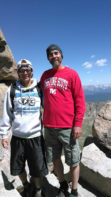
| Brandon and Coop on the summit of Mt. Evans |
After a good half hour or so on the summit we all headed back down uneventfully. Navigating the gully going down was not quite as sketchy as we thought it might be, though we turned the marshy valley into an extended adventure in an entirely unsuccessful quest to keep our feet dry. But hey, nothings perfect.
 |
| Coop and I on the summit of Evans |
The only thought once it was over was something like "what the Hell took me so long to do that?" The views and feeling of being above treeline with the whole world seemingly below you is undeniably intoxicating. Definitely one of the coolest things I have ever done in my life, and much tougher than I expected it to be (though my choice of route had a lot to do with that). I am already making plans to climb at least one more this year.
Overall it was somewhere around 9-10 miles (we all were gps watchless for the hike) with over 3000-3500 feet in elevation gain. Took I think about seven hours or so. 14,264 feet above sea level. All in all another awesome day in the Rocky Mountains!!!


No comments:
Post a Comment